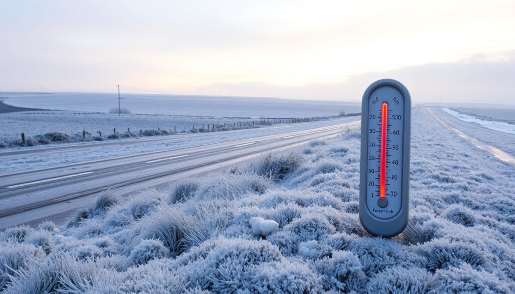
Ireland Weather Freezing Temperatures: Coldest Records & Forecast
There’s a reason the phrase “a soft day” is woven into Irish conversation — the island’s maritime climate usually delivers mild, damp weather, but every so often that reputation shatters when Arctic air pours in, turning green fields white and dropping the mercury to Siberian levels. This guide walks through Ireland’s most extreme freezing events, what Met Éireann meteorologists look for, and what current forecasts say about tonight’s frost risk.
Coldest temperature ever recorded in Ireland: -19.1°C (Markree Castle, County Sligo, 1881) ·
Average January temperature range: 4°C to 7°C ·
Lowest temperature during the 2010 Big Freeze: -15°C (some areas) ·
Forecast minimum for current cold spell (February 2026): -4°C
Quick snapshot
- -19.1°C in 1881 at Markree Castle, Co. Sligo (Met Éireann extreme records)
- The 2010 Big Freeze brought -17.5°C in Mayo (Met Éireann historical data)
- Met Éireann issues colour-coded ice warnings for freezing temperatures (Met Éireann National Forecast)
- Whether the 2026 cold spell will break any records (likely no)
- Exact lowest temperature during the 2010 Big Freeze varies by location
- Future frequency of freezing spells under climate change remains uncertain
- 1881: Lowest ever -19.1°C at Markree Castle, Co. Sligo
- December 2010: Big Freeze peaks with -17.5°C in Mayo
- February 2026: Arctic airmass brings -4°C lows
- Met Éireann to issue further updates every 6 hours (Met Éireann website)
- RSA driving advisories likely if freezing rain develops (Met Éireann website)
- Farmers’ Forecast provides a 7-day agricultural outlook (Met Éireann Farmers’ Forecast)
Six key facts, one takeaway: Ireland’s land temperature record has stood for nearly a century and a half.
| Fact | Value |
|---|---|
| Lowest temp ever | -19.1°C (1881) |
| Average January daytime high | 7°C |
| Average January nighttime low | 2°C |
| 2010 Big Freeze lowest | -15°C |
| 2026 cold spell forecast | -4°C |
| Coldest town (typical) | Drumshambo, Co. Leitrim (-18.7°C recorded) |
What is the coldest it’s ever been in Ireland?
Ireland’s lowest officially recorded temperature is -19.1°C, noted on 16 January 1881 at Markree Castle in County Sligo. That reading remains the national record to this day, according to Met Éireann’s weather extreme records. The weather service’s historical chart also shows a reading of -18.7°C at Lullymore, County Kildare, on 2 January 1979 — the 20th century’s lowest shaded-air temperature.
The record low of -19.1°C in 1881
The 1881 reading at Markree Castle was a shade temperature measured in a Stevenson screen. Contemporary newspaper accounts described a “terrific frost” that froze water pipes solid across the northwest. The record has survived 18 further decades because Ireland’s Atlantic air rarely stays cold long enough to produce such extremes.
Other notable low temperatures across the country
- -18.8°C at Lullymore, County Kildare (2 January 1979) — the 20th-century low (Met Éireann extreme records)
- -17.8°C at Mostrim, County Longford (7 January 1895)
- -17.2°C at Markree Castle (3 January 1947)
- -17.5°C at Straide, County Mayo (25 December 2010)
- The lowest grass minimum temperature was -19.6°C at Glasnevin, Dublin (12 January 1982)
Coldest towns and regions
Inland areas consistently see the lowest readings. The midlands and the Shannon basin are cold-air drainage zones. Drumshambo in County Leitrim has recorded -18.7°C, placing it among Ireland’s coldest settlements.
Ireland’s all-time cold record has survived since 1881 because the surrounding Atlantic Ocean acts as a thermal buffer, making -10°C very uncommon in lowland areas.
— Met Éireann
The implication: anyone living inland or in a valley bottom faces a much higher freeze risk than coastal residents.
Takeaway: Met Éireann data confirms the 1881 record holds because the Atlantic moderates extremes, but inland and valley zones remain vulnerable to sub-zero temperatures.
What year was the big freeze in Ireland?
The “Big Freeze” refers to the winter of 2010–2011. It began in late November 2010 and extended through January 2011, causing the most widespread disruption from snow and ice since 1982. Met Éireann recorded -17.5°C at Straide, County Mayo, on Christmas Day 2010.
The winter of 2010-2011
That December was Ireland’s coldest month since January 1987. Dublin Airport logged 24 consecutive days of air frost. The government activated the National Emergency Coordination Centre, and schools across the country shut for extended periods.
Impact of the Big Freeze
- Roads became impassable: the Road Safety Authority (RSA) urged drivers to avoid travel unless essential
- Water pipes burst in thousands of homes, especially in older buildings with poor insulation
- Livestock losses in the farming sector were severe, with sheep buried under snowdrifts in upland areas
- Airports experienced cancellations, and Dublin Airport ran out of de-icing fluid at one point
Farmers should monitor the Met Éireann Farmers’ Forecast closely during cold spells: it provides a 7-day outlook tailored to agricultural risk.
Avoid travel unless essential during ice warnings.
— Road Safety Authority
Comparison with other severe winters
Other severe Irish winters came in 1947 (when snow lay for six weeks in places), 1963 (the “Big Freeze” of that era), and 2018 (the “Beast from the East”). The 2010 event stands out for combining extreme cold with high population exposure and modern infrastructure strain.
The pattern: each of these events was driven by a high-pressure block over Scandinavia or Russia pulling Siberian air westward across Europe toward Ireland.
Will it freeze in Ireland tonight?
As of February 2026, Met Éireann’s National Forecast shows an Arctic airmass moving over Ireland, bringing overnight lows of -4°C in some areas. The weather service has issued ice warnings covering large parts of the country.
Current Met Éireann warnings
Met Éireann uses a three-tier colour system for freezing conditions. A Status Yellow ice warning means overnight temperatures are expected to drop below zero, with icy patches forming on untreated surfaces. The Met Éireann National Forecast provides the latest warning status, updated every six hours.
How to check local frost forecasts
Check the Met Éireann app or website for hourly temperature breakdowns. Pay attention to the “feels like” temperature, which accounts for wind chill. On clear nights with a snow cover, a forecast of -2°C can produce surface temperatures of -6°C due to radiative cooling.
Preparing for overnight freezing
- Bring pets inside and move tender plants to a greenhouse or indoors
- Leave your heating on a low overnight setting to prevent pipes freezing
- Check on elderly or vulnerable neighbours
- If driving, pack a blanket, torch, and a fully charged phone — the RSA advises avoiding travel unless essential during ice warnings
Why this matters: a -4°C night might not sound severe, but after weeks of damp, mild weather, untreated roads become lethal black ice.
What causes freezing temperatures in Ireland?
Ireland’s climate is classified as oceanic (Köppen Cfb), moderated by the Atlantic Ocean and the North Atlantic Drift. That keeps average winter temperatures between 4°C and 7°C. But when the wind direction changes, the buffer vanishes.
Arctic airmass influence
Cold spells occur when a high-pressure system over Scandinavia or Greenland directs Arctic or Siberian air south-westward across the Irish Sea. The airmass is dry and very cold. This setup produced both the 2010 Big Freeze and the 2026 event.
Maritime vs. continental effects
The Atlantic keeps coastal counties milder. The difference is stark: Dublin Airport averages 24.3 air-frost days per year while inland Casement Aerodrome averages 41.3, per Met Éireann’s Dublin Airport climate normals. Inland counties like Kildare, Laois, and Roscommon experience roughly twice the frost of Cork Harbour or Galway Bay.
Seasonal patterns
Air frost peaks in February (7.2 days per month at Dublin Airport) and January (7.1). Ground frost is more common: 15.2 days in January and 14.3 in February. Snow cover amplifies frost by reflecting sunlight and insulating the ground, though deep snow is rare outside upland areas like the Wicklow Mountains, where temperatures can reach about -10°C annually.
The trade-off: maritime moderation also means that when freezing does hit, it feels more severe because homes and infrastructure are designed for mild winters.
How does Met Éireann warn about freezing conditions?
Met Éireann issues colour-coded warnings specifically for ice and low temperatures. The system is designed to give the public, farmers, and emergency services enough lead time to prepare.
Color-coded weather warnings
- Status Yellow – Ice: Possible travel disruption. Surface ice on roads and paths likely. Take care.
- Status Orange – Ice: Significant impact expected. Widespread ice on untreated surfaces. Only travel if necessary.
- Status Red – Ice/Low Temperature: Rare. Widespread severe ice with prolonged sub-zero temperatures. Dangerous conditions. Avoid all travel.
The warnings are published on the Met Éireann National Forecast page and updated every six hours. An email alert service is available for registered users.
Farmers’ forecasts and specific advisories
Met Éireann publishes a dedicated Farmers’ Forecast every Tuesday and Friday. It provides a 7-day outlook with emphasis on frost risk, ground temperature, and wind chill. During a cold spell, the forecast flags risk to lambing, cattle, and stored fodder.
How to interpret freezing rain warnings
Freezing rain is especially dangerous: supercooled droplets freeze instantly on contact with surfaces, creating a transparent glaze. Met Éireann will flag the risk of freezing rain in its text forecast and, rarely, with a warning if conditions align. Drivers are advised to avoid all travel in such conditions — stopping distances increase tenfold on clear ice.
With climate change, the frequency of very cold Arctic outbreaks remains uncertain. Met Éireann’s climate projections suggest milder winters on average, but individual cold spells could still be severe when the jet stream pattern aligns.
The pattern: accurate warnings depend on local observations. Ireland has a dense network of synoptic stations and climate observers feeding real-time data to Met Éireann’s forecasting models.
Beast from the East Alert: Met Eireann Issues 2026 Warning provides more context on similar Arctic events.
Is Another Storm Coming to Ireland? Storm Amy & Beyond offers updates on active weather systems.
Timeline of freezing events in Ireland
- 16 January 1881: Lowest temperature ever recorded in Ireland: -19.1°C at Markree Castle, Co. Sligo (Met Éireann extreme records)
- 7 January 1895: -17.8°C at Mostrim, County Longford
- January 1947: Severe winter with snow cover lasting six weeks in places; -17.2°C at Markree Castle
- 2 January 1979: -18.8°C at Lullymore, County Kildare (20th century record)
- December 2010 – January 2011: The Big Freeze; widespread disruption; -17.5°C recorded on Christmas Day 2010
- February 2026: Arctic airmass brings freezing temperatures; Met Éireann issues nationwide ice warning; lows of -4°C (Met Éireann National Forecast)
met.ie, met.ie, x.com, en.wikipedia.org, met.ie, met.ie, facebook.com, facebook.com, simple.wikipedia.org
Frequently asked questions
Is it common for Ireland to have freezing temperatures?
Yes, frost occurs most winter nights inland. Dublin Airport averages 35 air-frost days per year, while inland Casement Aerodrome sees 41. Ground frost is even more common, with 87 days per year on average at Dublin Airport.
How long do cold snaps usually last in Ireland?
Most cold spells last 3 to 7 days before Atlantic air returns. Prolonged freezes are rare: the 2010 Big Freeze lasted roughly 8 weeks, making it one of the longest in modern records.
Does Ireland get snow every winter?
Most parts of Ireland see at least a few days of snowfall each winter, but it rarely settles for long in lowland areas. The Wicklow Mountains and other uplands see more frequent and longer-lasting snow cover.
What is the best way to stay safe during a freeze in Ireland?
Check Met Éireann’s National Forecast for updates. If driving, reduce speed, avoid untreated roads, and carry an emergency kit. Keep homes heated to prevent frozen pipes. Check on elderly neighbours.
What was the worst winter in Ireland’s history?
By temperature, the worst was 1881, with the national record of -19.1°C. By disruption, the 2010-2011 Big Freeze caused the most modern-era economic impact, with losses estimated at hundreds of millions of euros.
Are freezing temperatures more common in certain parts of Ireland?
Yes. Inland counties, the midlands, and the Shannon basin experience the most frost. Coastal areas, especially in the southwest and west, see far fewer freezing days due to the Atlantic’s moderating effect.
How do freezing temperatures affect Irish agriculture?
Frost kills tender crops, can harm lambing flocks, and damages fodder. Grass growth stops below 5°C, so prolonged freezes deplete winter feed. Met Éireann’s Farmers’ Forecast warns farmers of frost risk and wind chill up to 7 days ahead.
For anyone living in Ireland’s inland counties, the choice is clear: invest in frost protection for your home — lag pipes, insulate attics, and have a plan for livestock — or face the expense of burst pipes and fodder shortages when the Arctic air returns.
More related posts
 Volvo XC90 for Sale Ireland: Best Years, Prices & Problems
 Can Dogs Eat Pears? Safety, Benefits & Feeding Tips
 Best American Fridge Freezer Ireland: Deals & Prices
 Best Comic Book Stores in Dublin: City Centre Guide & Comparison
 Is Lucy Letby Still in Prison? 2026 Full Status Update
 Soft2Bet: Antifraud, KYC, and Account Security
 La Liga 2 Standings 2025/26: Live Table & Results
 St Agnes Church Crumlin – Mass Times, History and Contact Guide