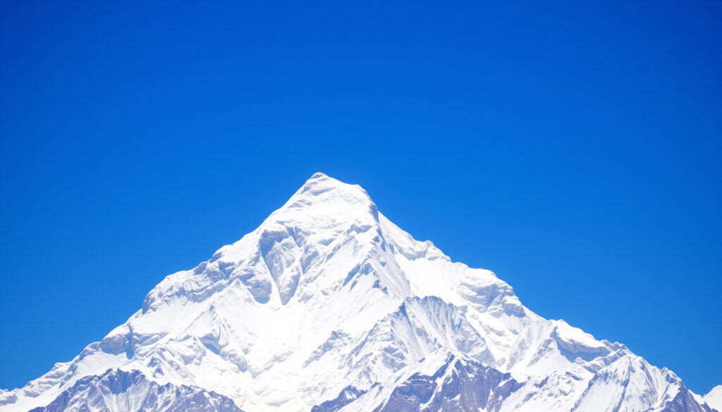
Where Is Mount Everest? Location, Height, and Key Facts
Most of us learned in school that Mount Everest is the world’s tallest peak, but its precise location is more complicated — the summit belongs to two nations at once, with real consequences for climbers, pilots, and planes. We pinpoint Everest’s exact spot, explain why the boundary matters, and clear up common questions.
Height: 8,848.86 m (29,031.7 ft) · Location: Border of Nepal and China (Tibet) · First ascent: May 29, 1953 · First ascenders: Edmund Hillary and Tenzing Norgay · Avg. summit temperature (Jan): -36°C (-33°F)
Quick snapshot
- Summit lies on the international border between Nepal and the Tibet Autonomous Region of China (Wikipedia)
- Official height 8,848.86 m as of 2020 (Daily Sabah)
- Whether George Mallory and Andrew Irvine reached the summit in 1924 remains unknown (Wikipedia)
- Exact number of bodies still on the mountain is unconfirmed (Britannica)
- First confirmed summit: May 29, 1953 (Wikipedia)
- 2020 joint survey established new official height (Daily Sabah)
- Over 800 climbers attempt the peak each year; permit fees continue to rise (Wikipedia)
- Ongoing tectonic uplift adds a few millimeters annually (Nepal Gateway Trekking)
Just six key facts capture the essentials of Everest’s geography and history:
| Attribute | Value |
|---|---|
| Highest point on Earth | Mount Everest |
| Elevation | 8,848.86 m (29,031.7 ft) |
| First ascenders | Edmund Hillary (NZ) and Tenzing Norgay (Nepal) |
| Year of first ascent | 1953 |
| Number of attempts per year | Around 800 climbers in peak season |
| Death rate | Approximately 1% of climbers |
Which country is Mount Everest in?
The straightforward answer is that Mount Everest sits on the border between Nepal and the Tibet Autonomous Region of China. The summit itself is the point where the two countries meet. According to Britannica (encyclopedia), the international boundary runs directly across the summit, a division confirmed by the 1961 Nepal-China boundary agreement. This dual jurisdiction means climbers must obtain permits from both sides depending on their route — Nepal’s Department of Tourism manages the south side, while China issues separate permits for the north (Britannica).
What continent is Mount Everest in?
- Everest is part of the Himalayas, which stretch across Asia. The mountain lies in the Mahalangur Himal sub-range (Britannica).
Asia is the continent that contains both Nepal and China, so the answer is straightforward — Everest is an Asian peak. The implication for travelers: accessing the mountain requires journeying to one of the most remote regions on the continent, often via Kathmandu or Lhasa.
Where exactly is Mount Everest located?
- Coordinates: 27.9881° N, 86.9250° E (Places Nepal (travel guide)).
The Nepal side falls in Solukhumbu District, Koshi Province, within Sagarmatha National Park (a UNESCO World Heritage site). The Chinese side is in Tingri County, Xigazê Prefecture, Tibet Autonomous Region, within Qomolangma National Nature Preserve (Nepal Hiking Team (trekking operator)).
Because the summit is a shared point, both Nepal and China claim it diplomatically, but climbers on the ground must follow the permit rules of whichever side they ascend from — there is no “neutral” zone at the top.
Why can’t planes fly over Mount Everest?
Commercial aircraft avoid the Everest region for two main reasons: physics and politics. At 8,848.86 m, the air is too thin for jet engines to generate enough lift for a safe climb over the summit, and the surrounding peaks create severe turbulence. Even if an engine failed, there is no glide ratio to reach a safe airport (Britannica). Additionally, airspace restrictions apply due to the sensitive border between Nepal and China (Wikipedia).
Why avoid seat 11A on a plane?
- Seat 11A on certain aircraft is near an emergency exit or at a window with restricted view — but the warning about “avoid seat 11A on flights near Everest” is a myth; airlines do not designate specific seats for that reason.
What is true: pilots on some routes near Kathmandu may fly higher than normal to clear the Himalayas, but they never intentionally fly directly over the summit. The catch for passengers: you won’t see the peak from a typical commercial flight window.
Can you fly to the top of Mount Everest?
No. Helicopters have landed on the summit — Didier Delsalle in 2005 — but that was a one-off demonstration. Commercial flights do not land on Everest; the nearest airports are Lukla (Nepal) and Lhasa (Tibet), both far below the summit (Britannica).
Airlines flying to Kathmandu accept a longer flight path to avoid the risk. For passengers, this means no scenic flyover of Everest — safety wins over spectacle.
What is the 2 pm rule on Mount Everest?
The “2 pm rule” is a widely accepted safety guideline: climbers attempting the summit must turn around by 2:00 PM local time, regardless of how close they are to the top. The reasoning is that afternoon weather conditions become dangerously unpredictable — winds increase, clouds roll in, and visibility drops (Wikipedia). Descending in darkness is far more dangerous than turning back early.
Why can’t you climb Mount Everest after 2pm?
- Weather in the afternoon often brings sudden storms and extreme cold (Britannica).
- Rescue helicopters cannot operate after dark.
The rule is not a formal regulation but a near-universal practice among expedition leaders. The pattern: those who ignore it often become part of the mountain’s casualty statistics.
How cold is it at the top of Mount Everest?
Summit temperatures average around -36°C (-33°F) in January and -19°C (-2°F) in summer, according to Britannica. With wind chill, the perceived temperature can drop to -60°C (-76°F) during winter storms. Even in the May climbing season, daytime highs rarely exceed -20°C. Six months on the mountain, one pattern: the cold is extreme enough to cause frostbite in minutes if skin is exposed. Climbers rely on supplemental oxygen and heated suits. The extreme cold is a non-negotiable hazard that demands careful preparation.
Who was the famous body found on Mount Everest?
The most famous unidentified body is known as “Green Boots,” believed to be Tsewang Paljor, an Indian climber who died in 1996. His body remained in a limestone shelter just below the summit for years (Britannica). Separately, the body of George Mallory was discovered in 1999 at 8,159 m, 75 years after he disappeared during the 1924 attempt (Wikipedia).
What happened to George Mallory?
- Mallory and Andrew Irvine vanished on June 8, 1924, during a summit attempt.
- Mallory’s body was found in 1999, but no camera was recovered, leaving it unclear whether they reached the top.
The uncertainty remains: if they did summit, they would have beaten Hillary and Norgay by 29 years. The trade-off for historians: we will likely never know for certain.
Is Andrew Irvine’s body still missing?
Yes. Irvine’s body has never been located. His camera — if ever found — could contain photographs that prove or disprove a 1924 summit.
Confirmed facts
- Mount Everest is the tallest mountain above sea level (Britannica)
- It lies on the border of Nepal and China (Wikipedia)
- The 2 pm rule is a safety guideline (Wikipedia)
What’s unclear
- Whether Mallory and Irvine reached the summit (Wikipedia)
- Exact number of bodies still on the mountain (Britannica)
- Exact number of climbers attempting each season varies (Wikipedia)
“We knocked the bastard off!” — Edmund Hillary, after summiting on May 29, 1953
Nepal issues around 800 climbing permits each season through the Department of Tourism, with fees generating substantial revenue.
Department of Tourism, Nepal
For anyone planning to climb Everest, the choices are stark: either secure a permit from Nepal’s south side or China’s north side, pay the fees (around $11,000 for Nepal), and respect the 2 pm rule — or risk becoming one of the mountain’s permanent residents. The location of Everest, shared by two countries, is not just a geographical trivia: it dictates every aspect of the climbing experience.
Related reading: Where is Everest on the map · Where is Mt. Everest located
För den som vill veta mer om dess imponerande höjd och exakta läge finns en utförlig artikel om Mount Everest som världens högsta berg.
Frequently asked questions
Is Mount Everest growing taller?
Yes. Tectonic pressure from the Indian plate pushing into the Eurasian plate causes the Himalayas to rise a few millimeters each year (Nepal Gateway Trekking). The 2020 remeasurement of 8,848.86 m reflects the latest official height.
How many people have died on Mount Everest?
Over 300 recorded deaths since records began. The death rate among climbers is approximately 1% (Wikipedia).
What is the best time to climb Everest?
The primary climbing season is April–May (pre-monsoon) and a secondary window in September–October (post-monsoon) (Wikipedia).
How much does it cost to climb Everest?
Nepal permit fees are around $11,000 per person, plus expedition costs that can exceed $50,000 (Wikipedia).
Can you see Mount Everest from Kathmandu?
No. The mountain is 160 km away and usually obscured by haze. The best views are from the Everest region itself.
Do you need oxygen to climb Everest?
Most climbers use supplemental oxygen above 8,000 m (the “death zone”). A small number of elite mountaineers have summited without it.
More related posts
 Where Does the Sun Rise? East Explained by Season and Latitude
 Kaya Scodelario Movies & TV Shows: Full Filmography Guide
 Dairy Free Easter Eggs 2026: Best Supermarket Picks
 Georgie & Mandy’s First Marriage Cast: Who’s Who in the Spin-Off
 Red Hot Chili Peppers: Members, Hits, History & Facts
 Evan Ferguson Roma Debut: 4 Goals in Hat-Trick Stunner
 Guy Ritchie’s The Covenant – Plot, Cast, Streaming and Reviews Guide
 Cliffs of Moher Parking: Costs, Free Options & Walk