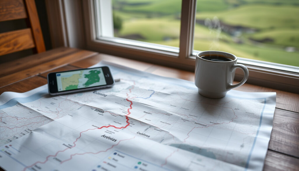
Route Planner Ireland: Google Maps Guide
Anyone who’s driven across Ireland knows that a good route planner can make the difference between a relaxed journey and a stressful one. Whether you’re commuting through Dublin traffic or planning a road trip along the Wild Atlantic Way, Google Maps is often the first tool people reach for.
Google Maps monthly active users: 1 billion+ ·
Countries covered: 220+ ·
Free route planners available: 10+ major apps ·
Ireland-specific route planners: AA, RAC, maps.ie ·
Live traffic data coverage: Global major roads
Quick snapshot
- Google Maps is free to use for driving directions (Google Maps Help)
- Google Maps supports up to nine stops per route (Google Maps Help)
- AA Route Planner and RAC Route Planner cover Ireland (theAA official site)
- Whether Waze or Google Maps provides more accurate traffic data in rural Ireland
- If Google Maps will continue offering free offline maps indefinitely
- Exact user base of maps.ie compared to global apps
- 2005: Google Maps launched
- 2009: Waze launched as community-based navigation
- 2013: Google acquired Waze
- 2020: Google Maps introduced real-time incident reporting
- Google Maps continues to integrate AI for better routing
- Waze remains a strong urban alternative
- Local Irish tools may expand features to compete
Five route planners, one pattern: each prioritises a different balance of global coverage, real-time alerts, or local accuracy.
| Label | Value |
|---|---|
| Number of route planners available in Ireland | 5 major options: Google Maps, Waze, AA Route Planner, RAC Route Planner, maps.ie |
| Free options | All five offer free basic route planning |
| Best for real-time traffic | Waze (community reports) and Google Maps (live data) |
| Best for Irish local accuracy | maps.ie |
| Custom route saving | Google My Maps (free) and Google Maps ‘Save trip’ feature |
How do I use Google Maps as a route planner?
Getting started with Google Maps for driving directions in Ireland takes just a few taps. The desktop and mobile workflows are slightly different, so here’s what to expect.
Step-by-step instructions for driving directions in Ireland
On desktop, open Google Maps directions interface and click Directions. Enter a starting point and your destination — you can type an address, click on the map, or add a place name. Then choose Driving as your travel mode. Google Maps will show suggested routes; click one to see detailed steps (Google Maps Help). You can also expand the route details for turn-by-turn directions.
- Up to nine stops can be added per trip, including the final destination.
- To avoid tolls or motorways, open Options and tick the relevant boxes.
- Use Depart at or Arrive by to plan around specific times (Google Maps Help).
Accessing real-time traffic and alternative routes
Live traffic data is built into Google Maps. As you plan, the app colour-codes roads: green for smooth, yellow for moderate, red for congestion. Alternative routes appear automatically if a faster path exists. This is especially useful in Irish cities like Dublin, Cork, and Galway during peak hours.
“Google Maps provides turn-by-turn navigation for car journeys in Ireland, with live traffic data to help avoid delays.”
Google Maps Help (Google’s official documentation)
For Irish drivers, real-time traffic can mean the difference between a 20-minute commute and an hour stuck on the M50. Google Maps’ live data gives you a fighting chance to dodge delays.
The implication: Google Maps is a robust daily driver for most Irish routes, provided you have an internet connection. Offline maps are available but require pre-downloading.
How do I create a custom route in Google Maps and save it?
Sometimes the default routes don’t match your preferred backroad or scenic detour. Here’s how to build and store your own.
Using Google My Maps to draw and save custom routes
Google My Maps is a free tool that lets you create personalised maps with multiple stops. Open Google My Maps, click Create a new map, and use the line tool to draw your route. You can also add directions layers to get turn-by-turn instructions. Once finished, save the map to your Google account (YouTube tutorial: Google My Maps).
Note: Custom routes made in My Maps are not directly navigable in the Google Maps app – you open them as a separate map layer. For many drivers, this is a workaround rather than a seamless feature.
Saving a route in Google Maps for later use
In the mobile Google Maps app, after planning a trip, tap the destination pin and select Save or add a label (e.g., “Weekend trip to Kinsale”). The route appears in your Saved tab for quick access later. On desktop, you can share the route link to yourself or bookmark it in your browser.
Google Maps’ native route saving is simple but limited – it retains the destination and mode, not the exact path you chose. For precise custom routes, My Maps is the better (if clunkier) option.
What this means: if you regularly drive the same custom itinerary – delivering goods across Munster or visiting multiple farm suppliers – My Maps is your best free bet.
What is the best route planner for cars?
No single planner fits every need. The “best” depends on whether you prioritise real-time alerts, local detail, or offline access.
Comparison of top route planners: Google Maps, Waze, AA Route Planner, RAC, maps.ie
Five free tools dominate the Irish market. Here’s a head-to-head look at what each brings to the table.
Four planners, one split: global giants offer breadth, local specialists offer depth.
| Feature | Google Maps | Waze | AA Route Planner | maps.ie |
|---|---|---|---|---|
| Free basic routing | Yes | Yes | Yes (theAA official site) | Yes |
| Real-time traffic | Live data | Community reports | Traffic updates | Basic |
| Offline maps | Yes | No | No | No |
| Ireland-specific detail | Good urban coverage | Good urban reports | UK/Ireland focus | Local Irish roads |
| Multi-stop planning | Up to 9 stops | Single destination only | Single route | Single route |
| Police/hazard alerts | Incident reporting | User-submitted | Limited | No |
Factors to consider when choosing a route planner in Ireland
- Real-time data: Waze excels at urban hazard alerts; Google Maps is stronger for overall traffic patterns.
- Local accuracy: maps.ie specialises in Irish roads and may catch small rural lanes that global apps miss.
- Offline capability: Only Google Maps offers offline navigation – a lifesaver in areas with patchy mobile signal.
- Cost: All are free, though AA and RAC offer premium features (e.g., advanced route options) for a fee.
“AA Route Planner provides detailed routes for Ireland, but some forum users note it may only list town and city names for certain destinations.”
The trade-off: global apps give you convenience everywhere but may overlook a narrow boreen in County Clare. Local tools like maps.ie fill that gap at the cost of fewer features.
Is Waze still better than Google Maps?
The “Waze vs Google Maps” debate is old, but for Irish drivers it’s still relevant. Both apps now share incident reporting, but their strengths differ.
Waze strengths: community alerts, police traps, real-time updates
Waze’s core advantage is its crowd‑sourced data. Users report accidents, speed traps, and road closures in real time. For urban commutes in Dublin or Cork, Waze often reroutes around jams faster than Google Maps because of this instant feedback loop (Google Maps Help notes that Google also offers incident reporting since 2020). However, outside major towns, user density drops, so alerts become sparse.
Google Maps strengths: offline maps, public transit, business information
Google Maps counters with offline map downloads – a critical feature for rural Ireland where 4G can be unreliable. It also integrates public transport timetables, business hours, and reviews. For a traveller who needs more than just driving directions, Google Maps is the Swiss Army knife.
Waze lacks offline maps entirely. If you lose signal halfway through the Wicklow Mountains, your route disappears. Google Maps keeps working if you pre-downloaded the area.
Performance in Ireland: both viable but differences in local data
Both apps route accurately on main roads. In a 2024 Reddit thread, Irish drivers noted that Waze’s police alerts are more reliable in urban zones, while Google Maps better handles narrow rural lanes because its map data is more complete. There’s no clear winner – your choice depends on where you drive.
The pattern: Waze wins for urban commuters who want to avoid every speed camera; Google Maps wins for anyone who drives cross-country or values multi-modal planning.
Is Google Maps route planner free?
Short answer: yes. But it’s worth understanding what “free” includes and where competitors might charge.
Free vs premium features of Google Maps
Google Maps is completely free for driving directions, voice navigation, live traffic, and offline downloads. No subscription, no hidden fees. The same applies to the mobile app. Even the Google Maps Platform Routes API (for developers) is free up to a monthly usage limit – but that’s for building apps, not for end users.
- Turn-by-turn navigation: free.
- Multiple stops: free.
- Offline maps: free.
- Avoid tolls/motorways: free.
Cost of alternative route planners
AA Route Planner and RAC Route Planner offer free basic routing, but premium subscriptions unlock advanced features like custom avoidance profiles or detailed journey cost breakdowns. MyWay Route Planner markets a free version for delivery drivers in Ireland, with paid upgrades for fleet management (MyWay Route Planner (business routing service)).
“AA Route Planner’s basic service is free, but some premium features – like faster route calculation – require a subscription.”
The implication: for the vast majority of Irish drivers, free tools are more than adequate. Only businesses with complex logistics need to pay.
Google Maps is genuinely free – no bait-and-switch. That makes it the default choice until a specific need (e.g., rural lane precision) forces you to a specialist.
Clarity: what’s confirmed and what’s still fuzzy
Confirmed facts
- Google Maps is free for route planning (Google Maps Help)
- Up to nine stops per route (Google Maps Help)
- AA Route Planner covers Ireland (theAA official site)
- Waze relies on user-submitted reports (Google Maps Help comparison)
What’s unclear
- Whether Google Maps or Waze is more accurate for rural Irish traffic
- If Google Maps will keep offline maps free forever
- Exact user base of maps.ie vs global competitors
- Whether AA Route Planner’s “limited to town names” issue (reported on Tripadvisor) still persists
Expert perspectives
“Google Maps allows you to add up to nine stops on a route, including the final destination – useful for planning multi-stop trips across Ireland.”
Google Maps Help (official desktop documentation)
“AA Route Planner provides end-to-end routes for Ireland with start and end controls and map navigation instructions.”
theAA (official route planner for Ireland)
“maps.ie is an Irish site focused on driving, walking, and cycling routes across the Republic of Ireland using up-to-date Ordnance Survey data.”
Summary
Google Maps is the strongest all-rounder for route planning in Ireland – free, reliable, and packed with features like offline maps and multi-stop routing. But it’s not perfect for every scenario. Waze is better for dodging urban traffic jams, AA Route Planner offers trustworthy UK/Ireland coverage, and maps.ie provides unmatched local detail on narrow country roads. For the Irish driver who spends time both in the city and the countryside, the pragmatic choice is to keep two apps installed: Google Maps for everyday navigation, and maps.ie or Waze as a secondary tool for specific needs. For delivery drivers and businesses, MyWay Route Planner may justify a look. The decision is clear: use the free global tool, but don’t ignore the local experts.
Related reading: Nenagh to Limerick Bus: Full Timetable, Fares & Operator Guide · GoCar Van Rental Ireland 2025: Vans, Prices & Requirements
Frequently asked questions
Does Google Maps work offline in Ireland?
Yes. You can download specific areas of Ireland for offline navigation in the Google Maps app. This is useful in regions with poor mobile signal.
Can I use Google Maps to plan a route with multiple stops?
Yes. Google Maps allows up to nine stops (including the final destination) in a single route on both desktop and mobile.
Is there a route planner that avoids toll roads in Ireland?
Yes. Google Maps, Waze, and AA Route Planner all offer options to avoid toll roads. In Google Maps, open Options and tick “Avoid tolls”.
How do I share a Google Maps route with someone?
After planning a route, click “Share” or copy the directions link. You can send it via email, text, or messaging apps.
Can I use Google Maps for cycling directions in Ireland?
Yes. Google Maps includes a cycling mode that suggests bike-friendly paths and routes.
Does Waze offer offline maps for Ireland?
No. Waze requires an active internet connection to function. For offline use, Google Maps is the better choice.
Which route planner is best for long-distance driving in Ireland?
Google Maps is recommended for long-distance drives because of its offline support, live traffic, and fuel station information. AA Route Planner is also a strong contender for motorway routes.
More related posts
 Sir John Rogerson’s Quay: History, Location & Dublin Guide
 Georgie & Mandy’s First Marriage Cast: Who’s Who in the Spin-Off
 Where Does the Sun Rise? East Explained by Season and Latitude
 Ireland Weather Freezing Temperatures: Coldest Records & Forecast
 How Old Is Holly Wheeler in Season 5? Age, Recast & Retcon
 A Big Bold Beautiful Journey: Why It Flopped & Where to Watch
 The Book Centre Kilkenny: Family-Run Bookshop & Café
 Houses for Sale in Trim – Listings, Prices & Estate Agents