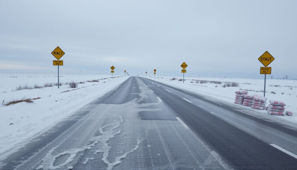
Moderate Snow Ice Warning – Meaning, Impacts and Preparation
A moderate snow and ice warning signals conditions that could disrupt daily life across affected regions of the United Kingdom. When the Met Office issues such a warning, it indicates that wintry weather is likely to create hazardous travel conditions, potential power disruptions, and increased risks for vulnerable populations. Understanding what these warnings mean and how to respond can help individuals and communities prepare effectively for potentially dangerous conditions.
The UK’s warning system categorizes snow and ice hazards into distinct severity levels, each carrying specific guidance for the public. Moderate warnings typically correspond to yellow and amber designations, which communicate different degrees of likelihood and potential impact. These warnings may be issued up to seven days in advance, allowing residents adequate time to make necessary arrangements and adjustments to their routines.
Current weather patterns have brought Arctic air masses across much of the British Isles, resulting in below-average temperatures, widespread frosts, and wintry showers affecting multiple regions simultaneously. The Met Office maintains an interactive warnings map that displays active alerts across Scotland, Wales, Northern Ireland, and England, with color-coded zones indicating the severity level for each affected area.
What Does a Moderate Snow and Ice Warning Mean?
A moderate snow and ice warning represents the Met Office’s assessment that wintry conditions pose a meaningful risk to public safety and infrastructure. Within the three-tier color-coded system, moderate warnings correspond to yellow and amber designations, each carrying distinct implications for daily life and travel plans.
Moderate (Yellow/Amber equivalent)
Slippery roads, travel delays, minor disruptions
Typically 12-48 hours for active warnings
Check Met Office interactive map for details
The Met Office warning system combines two key factors when determining severity: the likelihood of hazardous weather occurring and the potential severity of its impacts on communities and infrastructure. Yellow warnings indicate that some impacts are likely, such as travel delays or disruptions to daily activities. Amber warnings signal a higher likelihood of widespread disruption, including road and rail closures, power interruptions, and potential risks to life and property.
Understanding the Color-Coded Warning Levels
The three-tier system provides clear guidance at each stage of severity. Yellow, described as “be aware,” represents the least severe category, where weather conditions may cause minor inconvenience requiring basic precautions. The public is advised to check forecasts regularly and plan ahead for possible delays.
Amber warnings, designated as “be prepared,” indicate an elevated threat level where the likelihood of bad weather causing significant disruption increases substantially. This tier often triggers alerts across multiple sectors, including transport operators, utility companies, and health services, allowing them to activate contingency measures.
Red warnings, the most severe classification, reserve “take action” for circumstances where widespread damage, extended power cuts, and risks to life are likely. Red alerts require immediate response, with authorities urging the public to avoid travel and take shelter.
| Aspect | Details |
|---|---|
| Severity | Moderate disruptions expected; yellow/amber level |
| Precipitation | 2-5 cm snow possible at low levels; 10-20 cm in amber areas |
| Temperatures | Below freezing with ice formation on untreated surfaces |
| Primary Risks | Slippery surfaces, travel delays, potential power interruptions |
| Higher Ground | 30-40 cm accumulation possible in elevated regions |
| Duration Range | 12-72 hours depending on specific warning area |
What Should You Do During a Moderate Snow and Ice Warning?
When a moderate snow and ice warning is issued, taking proactive measures can significantly reduce risks to personal safety and minimize disruption to daily activities. Preparation before adverse weather arrives proves far more effective than attempting to respond once conditions deteriorate.
Essential Travel Precautions
Travel disruption represents one of the most common and immediate impacts of snow and ice warnings. Motorists should postpone non-essential journeys whenever possible and ensure vehicles are equipped for winter conditions. Those who must travel should carry emergency supplies, including warm clothing, food, water, and a charged mobile phone. The Met Office advises avoiding unnecessary journeys during amber warnings, particularly in affected regions like northern and eastern Scotland where blizzard conditions may develop.
Public transport users should check for service updates before departing, as rail, bus, and flight services frequently experience delays or cancellations during wintry conditions. Road conditions can deteriorate rapidly, with ice forming on untreated surfaces and visibility reducing significantly during snow showers.
Home and Property Preparation
Protecting properties and ensuring adequate supplies within the home forms a crucial aspect of warning response. General preparation steps include insulating pipes to prevent freezing, maintaining heating systems, and ensuring adequate food and medication supplies for several days. Clearing snow and ice from paths and driveways reduces slip hazards, while ensuring mobile devices remain charged provides essential communication capability during potential power outages.
During moderate to severe snow and ice warnings, checking on elderly neighbors, those with health conditions, and households without adequate heating becomes particularly important. Cold weather places significant strain on health services, with documented increases in mortality among vulnerable populations during prolonged cold spells.
Workplace and Business Considerations
Employers should adapt operational plans to account for severe weather, prioritizing employee safety while maintaining essential services. Workplaces are advised to allow flexible working arrangements where possible, ensure property security, and communicate clearly with staff regarding expectations during hazardous conditions. Businesses should review their emergency procedures and ensure adequate staffing contingency plans exist for severe weather scenarios.
Where Are Current Moderate Snow and Ice Warnings Active?
Active snow and ice warnings currently span multiple regions across the United Kingdom, reflecting the widespread impact of Arctic air masses affecting the British Isles. The Met Office maintains real-time updates through its interactive warning map, which displays color-coded zones indicating the severity and type of hazard for each affected area.
Scotland and Northern Regions
Amber snow warnings have been issued for northern and eastern Scotland, with some warnings remaining in effect until midday in affected areas. These warnings predict significant snow accumulation, with 10-20 centimeters expected at lower elevations and 30-40 centimeters possible on higher ground. Blizzard conditions may develop due to strong winds accompanying the precipitation, creating dangerous travel conditions across the Highlands and surrounding regions.
Yellow snow and ice warnings extend across broader areas of Scotland, with some alerts spanning more than 48 hours in duration. Northern Ireland similarly faces widespread yellow warnings affecting all counties, with hazardous driving conditions developing on untreated roads and pavements.
England and Wales
Multiple yellow warnings cover extensive areas of England, including the East Midlands, East and North East England, Yorkshire, and regions extending into central and southern areas. Warnings in Norfolk, Durham, and Angus illustrate the wide geographic distribution of current alerts, with some extending until Sunday and Monday respectively.
Welsh regions, including areas around Cardiff and Gwynedd, appear on the active warnings map alongside South West England locations such as Devon and Cornwall. The overlapping nature of these warnings means that several regions face concurrent alerts, requiring vigilance and adherence to guidance across multiple hazard types.
The Met Office interactive map at weather.metoffice.gov.uk/warnings-and-advice provides continuously updated information on active warnings. Given that multiple warnings overlap and conditions can change rapidly, checking official sources before making travel or activity decisions remains essential throughout the warning period.
What Are the Impacts of a Moderate Snow and Ice Warning?
The impacts of moderate snow and ice warnings extend across multiple sectors, affecting individual safety, transportation networks, utility services, and public health systems. Understanding these potential consequences helps communities prioritize precautions and allocate resources effectively during warning periods.
Travel and Transportation Disruption
Transportation networks bear some of the most immediate and visible impacts during snow and ice events. Icy roads and pavements create hazardous driving and walking conditions, while accumulating snow can strand vehicles and necessitate road closures. Road and rail closures, alongside bus, train, and flight delays or cancellations, frequently accompany moderate and severe warnings.
Wind-driven snow during blizzard conditions significantly reduces visibility, creating additional hazards for motorists and pedestrians alike. The combination of slippery surfaces and reduced visibility contributes to increased accident rates during warning periods, reinforcing the importance of avoiding non-essential travel.
Infrastructure and Utility Effects
Power infrastructure faces elevated stress during prolonged snow and ice events, with ice accumulation on power lines and equipment potentially causing outages. Some communities may become isolated due to road closures and infrastructure damage, limiting access to essential services and supplies. The Met Office notes that power cuts represent a significant risk during amber-level warnings, making preparation for extended utility interruptions advisable.
The physical effects of freezing temperatures and precipitation include pipe bursts due to frozen water expanding within plumbing systems, roof damage from accumulated snow load, and frost damage to gardens and agricultural crops. While the article focuses on the impact of cold weather, for those interested in a different kind of competition, Ryder Cup points explained explains how Ryder Cup points are awarded.
Public Health Considerations
Health services experience increased demand during cold weather events, with documented rises in deaths among elderly and vulnerable populations during prolonged cold spells. Amber cold health alerts currently extend across much of England, including the North East, North West, and Yorkshire regions, indicating anticipated significant impacts on health and social care services.
Emergency department visits for fall injuries, respiratory conditions, and cardiovascular events typically increase during periods of severe winter weather. The combination of physical hazards and physiological stress from cold exposure creates multi-faceted health risks that disproportionately affect older adults, those with pre-existing medical conditions, and households without adequate heating.
Cold health alerts operate separately from weather warnings but often accompany them during severe winter conditions. An amber cold health alert signifies that significant health and social care impacts are possible, with the elderly and those with chronic illnesses facing particular risk during extended cold periods.
Warning Timeline and Duration
Snow and ice warnings vary significantly in their duration and timing, with some representing brief hazardous periods while others extend across multiple days. Understanding the typical timeline of warning evolution helps communities prepare appropriate responses and expectations.
- Warning Issuance: Warnings are typically issued up to seven days ahead when sufficient confidence exists regarding approaching winter weather, allowing communities time to prepare and make contingency plans.
- Warning Update: As conditions develop and forecasts refine, the Met Office updates warning parameters, including affected areas, severity levels, and expected timing. Monitoring for updates throughout the warning period remains important.
- Warning Peak: The period of maximum impact typically occurs when precipitation aligns with the coldest temperatures and strongest winds, creating the most hazardous conditions. Exact timing varies by location and warning type.
- Gradual Improvement: Conditions gradually improve as temperatures rise, precipitation decreases, or weather systems move away from affected areas. Recovery times vary based on accumulated snow and ice depths.
- Warning Expiry: Warnings conclude when the threat diminishes below thresholds requiring continued public awareness. Residual hazards may persist on untreated surfaces even after official warnings expire.
Specific current warnings illustrate these variations: some ice warnings operate on short timeframes such as 7pm Monday through 10am Tuesday, while snow warnings may extend from 3am to 6pm Tuesday or from 6pm Tuesday through 9pm Thursday. Chief forecasters note that the current cold spell is expected to continue into next week, with ongoing wintry hazards requiring sustained vigilance.
Established Facts and Areas of Uncertainty
Transparency regarding what is known with confidence versus what remains uncertain helps readers appropriately calibrate their expectations and responses to snow and ice warnings. The following assessment distinguishes established information from areas where further updates may refine understanding.
Established Information
- The Met Office operates a three-tier color-coded warning system for snow and ice hazards
- Yellow warnings indicate likelihood of some impacts including travel delays
- Amber warnings signal increased likelihood of widespread disruption
- Current Arctic air masses have brought below-average temperatures across the UK
- Multiple yellow and amber warnings are currently active across Scotland, England, Wales, and Northern Ireland
- Power cuts, travel delays, and health service pressures represent documented impacts
- Warnings are issued up to seven days in advance when confidence allows
Information That Remains Unclear
- Precise accumulation amounts for specific locations may vary from forecasts
- Exact timing of warning expirations depends on evolving weather patterns
- The full extent of infrastructure impacts will only become clear as events unfold
- Whether additional regions may be added to warning areas requires ongoing monitoring
- The precise duration of the current cold spell remains subject to forecast refinement
- Local authority response capacity in heavily affected areas requires verification
Forecast confidence for snow and ice events typically ranges between 80 and 90 percent for the initial warning issuance, improving as events approach. Given this inherent uncertainty, regular monitoring of official Met Office forecasts throughout warning periods allows individuals to adapt plans as conditions develop and forecasts become more precise.
The Broader Context of Winter Weather Warnings
Snow and ice warnings do not occur in isolation but represent part of broader seasonal weather patterns that affect the United Kingdom each winter. The current warning cycle reflects the establishment of Arctic maritime air masses over the British Isles, a pattern that typically brings temperatures significantly below seasonal averages and creates conditions favorable for wintry precipitation.
The Met Office warning system was developed through extensive research into the relationships between weather conditions and their impacts on society. By combining probability assessments with impact forecasting, the system aims to provide actionable guidance that helps communities balance the disruption of precautionary measures against the risks of inadequate preparation.
Public awareness and response to weather warnings have evolved significantly over recent decades, supported by improved communication channels and increased accessibility of forecast information. Mobile applications, website alerts, and integrated weather services allow individuals to receive timely updates directly, reducing reliance on traditional broadcast media for urgent safety information.
Climate research indicates that while long-term temperature trends show warming, short-term extreme weather events—including severe winter conditions—remain entirely consistent with natural climate variability. The mechanisms driving Arctic air outbreaks and their interaction with Atlantic weather systems continue to produce significant winter weather events across the British Isles.
Sources and Expert Guidance
Weather warnings derive from the expertise of Met Office meteorologists who analyze atmospheric conditions, model forecast outputs, and assess potential impacts. The following sources provide authoritative information regarding current warnings and recommended precautions.
The Met Office combines impact potential and likelihood when determining warning severity, ensuring that the public receives consistent guidance that reflects both the probability of hazardous weather and its potential consequences for communities.
During amber warnings, the increased likelihood of bad weather causing travel delays, road and rail closures, power interruptions, and potential risks to life and property requires the public to change plans and protect themselves and their properties from the anticipated conditions.
Current reporting from national news sources confirms active amber and yellow warnings across multiple UK regions, with chief forecasters indicating that wintry hazards will persist through the coming week. The Independent reports on the specific impacts currently affecting Scottish regions and the broader health service considerations accompanying this cold snap.
Summary
A moderate snow and ice warning signals conditions that require heightened awareness and proactive preparation, corresponding to yellow and amber designations within the Met Office’s color-coded system. Current warnings span extensive regions of Scotland, England, Wales, and Northern Ireland, with amber alerts indicating elevated risks of travel disruption, power interruptions, and health service pressures. Those living in or traveling to affected areas should monitor official forecasts regularly, avoid unnecessary journeys where possible, ensure adequate home supplies, and check on vulnerable neighbors. The interactive Met Office warning map provides real-time updates on active alerts across all affected regions.
Frequently Asked Questions
What does a moderate snow and ice warning mean for my daily activities?
A moderate warning indicates potential disruption to travel and daily routines. Yellow warnings suggest possible delays, while amber warnings signal likely impacts including road closures and power interruptions. Adjust plans accordingly and allow extra time for essential journeys.
How is a moderate warning different from severe warnings?
Moderate warnings correspond to yellow and amber levels, indicating some impacts or increased likelihood of widespread disruption. Red warnings represent the most severe category, requiring immediate action to avoid travel and seek shelter due to life-threatening conditions.
How long do typical snow and ice warnings last?
Warning durations vary significantly, from brief ice warnings spanning 12-15 hours to extended snow warnings lasting 48-72 hours or longer. Current warnings show variations including 7pm Monday to 10am Tuesday ice warnings and multi-day snow warnings extending through Thursday.
Where can I find the most current warning information?
The Met Office interactive map at weather.metoffice.gov.uk/warnings-and-advice provides real-time updates on all active warnings. Checking this resource before making travel decisions ensures access to the latest information as conditions evolve.
What essential supplies should I have during a snow and ice warning?
Prepare an emergency kit including warm clothing, food and water for several days, medications, phone charger, torch, and basic tools. Ensure adequate heating fuel and consider supplies for vulnerable neighbors who may need assistance during prolonged warnings.
Should I travel during an amber snow warning?
Amber warnings indicate that significant disruption is likely. Only undertake essential journeys and ensure your vehicle is properly equipped for winter conditions. Check transport operator updates before departing and carry emergency supplies in case of unexpected delays.
How accurate are Met Office snow and ice forecasts?
Forecast confidence for snow and ice events typically ranges from 80-90 percent at warning issuance, improving as events approach. Given this inherent uncertainty, monitoring for forecast updates throughout the warning period helps refine planning and response.
More related posts
 Plug-in Wall Lights – Best 2025 Picks and Installation Guide
 Laura Geller Foundation Reviews – Ideal for Mature Skin
 Dingle v St Brigid’s 2026: Final Score & Match Report
 Samuel L. Jackson: Drug Conviction, Sobriety & Breakthrough
 Thomas Brodie-Sangster Movies and TV Shows: Complete Guide
 Eddington (Film): Plot, Cast, Controversy & Reviews
 I Am Legend 2: Cast, Director & Development Update
 GoCar Van Rental Ireland 2025: Vans, Prices & Requirements